**Universal binary ready for Apple Silicon processors!**
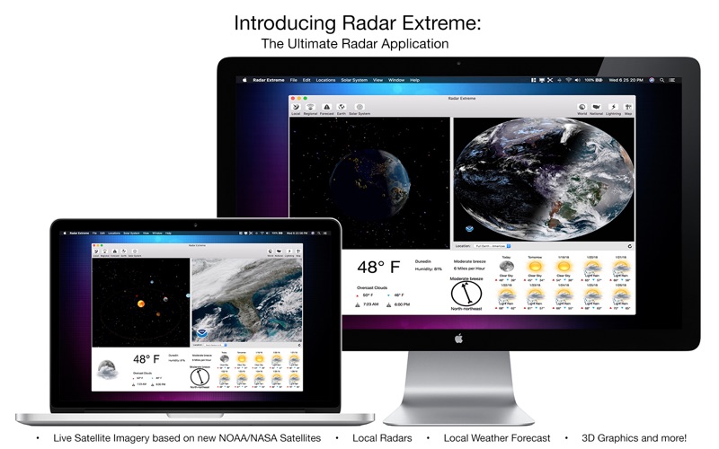
Introducing Radar Extreme, a powerful and easy to use Radar, Weather, Satellite, Lightning, Earthquake, and Hurricane Tracker. Radar Extreme features hundreds of NEXRAD Local Radars, dozens of Regional Radars, 14 World Radars, Local Weather Conditions for over 200,000 locations around the globe, 7 Lightning Intensity Radars, a National U.S. Radar, even interactive Solar System, 3D Earth, and an Interactive Map that shows Precipitation, Temperature, Clouds, Rain, Snow, Wind, and Sea Level Pressure individually. If that wasnt enough, Radar Extreme also offers extremely descriptive textual local weather Forecasts for Day and Night; letting you know exactly what conditions will be like for a given period of the day — and whether or not you should bring an umbrella.
Local Weather features photorealistic Day and Night time graphics, Ten Day Weather Forecasts, Wind Speed/Direction, Humidity, Highs/Lows, and much more. Local Weather Conditions are shown in the Menu Bar (Dark Theme compatible!) and a live animated NEXRAD Local Radar in the Dock. All three panes can be resized independently, with full Multi-touch gestures included. With all these features, Radar Extreme offers more Radars than any other application in the world, and best of all, Radar Extreme offers incredibly advanced features at a ridiculously affordable price of only U.S. $4.99!
Advanced and Easy to Use Features!
- Hundreds of "NEXRAD Next Generation" Local Radars all over the U.S.; with each Radar featuring independent layers, with 6 Radars per location: Base Reflectivity, Storm Relative Motion, Base Velocity, One-Hour Precipitation, Composite Reflectivity, and Storm Total Precipitation
- Dozens of Regional Radars give you a glimpse of whats going on in the immediate surrounding vicinity
- 18 World Radars (Full Color GOES-16 Satellite) with 17 Radars per location
- Local Weather features Photorealistic Day/Night Graphics, with over 200,000 locations around the globe supported; updates every 15 minutes
- Innovative 7 Lightning Radars around the world show Lightning Intensity for a given region
- National U.S. Radar, with a high resolution option
- Textual Forecast gives detailed descriptions for different periods throughout the day (Provided by U.S. National Weather Service)
- Interactive 3D Solar System shows Sun, Planets, and Asteroid Belt
- Interactive 3D Earth shows latest Earthquakes, Tropical Storms, and Live Clouds
- Interactive Map shows the latest Precipitation, Temperature, Clouds, Rain, Snow, Wind, and Sea Level Pressure
- Each Radar can be switched between locations on the fly
- Each Radar features Reload button to make sure you always have the latest data
- Dock Icon shows Animated NEXRAD Local Radar
- Local Weather supports Unlimited Multiple Locations, Imperial/Metric systems,F°/C°; 24 Hour Clock Option
- Local Weather Conditions in menubar (Dark Theme compatible, must be enabled in Preferences)
- Multi-Touch gesture and Retina Display support included
- Super advanced, yet super easy to use
*Please note Local Radar, Regional Radar, and Textual Forecast features are for the United States only*


